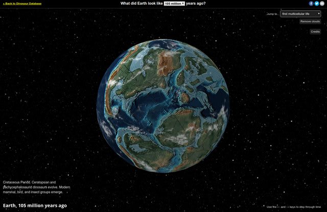
Some elements of this visualization are not adjusted for time (eg. cloud and star positions). The locations are accurate to ~100 km. The coloring of the maps is based on elevation and bathymetry: dark blue = deep water, light blue = shallow water; dark green, green, tan, brown, white = ground in increasing order of elevation.
4 Comments
Sort: